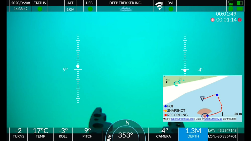
Hi, Im a commercial diver from Sweden who has just started using a Seabotix LBV300-5 on the side for our projects. A lot to learn.. Onboard i have a sonar, MicronNav positioning system and Seanet Pro on the computer. Next week i will be inspecting 500m seabed for a future pipeline project. As Im told i can add charts/maps on the software so that i can keep the rov within the planned trench and mark the obstacles on the map. So i need to cut the area from a map with Lat,Long positions on the corners and also the distance between the corners of that piece of map and add this chart on the software. My question is, what map program is best and easiest for this purpose? I have tried eniro maps yesterday, it took long time and made me upset. Tried google earth but couldnt find those tools. Is there any other easier way or an application? How do you do? I would appreciate any tips and recommendations.
Cheers.
Serhat
.